In the summer of 2018, I lived in Brooklyn and worked at Open Style Lab in Manhattan. Every day that summer, I logged exactly where I walked and where I went on the island. I wanted to walk down as many of the streets as I possibly could. After I moved back to Los Angeles, I created a weighted map to explore the scale and breadth of my exploration that summer. The lines are visually weighted if I took the same path more than once to show frequency of taking certain paths.
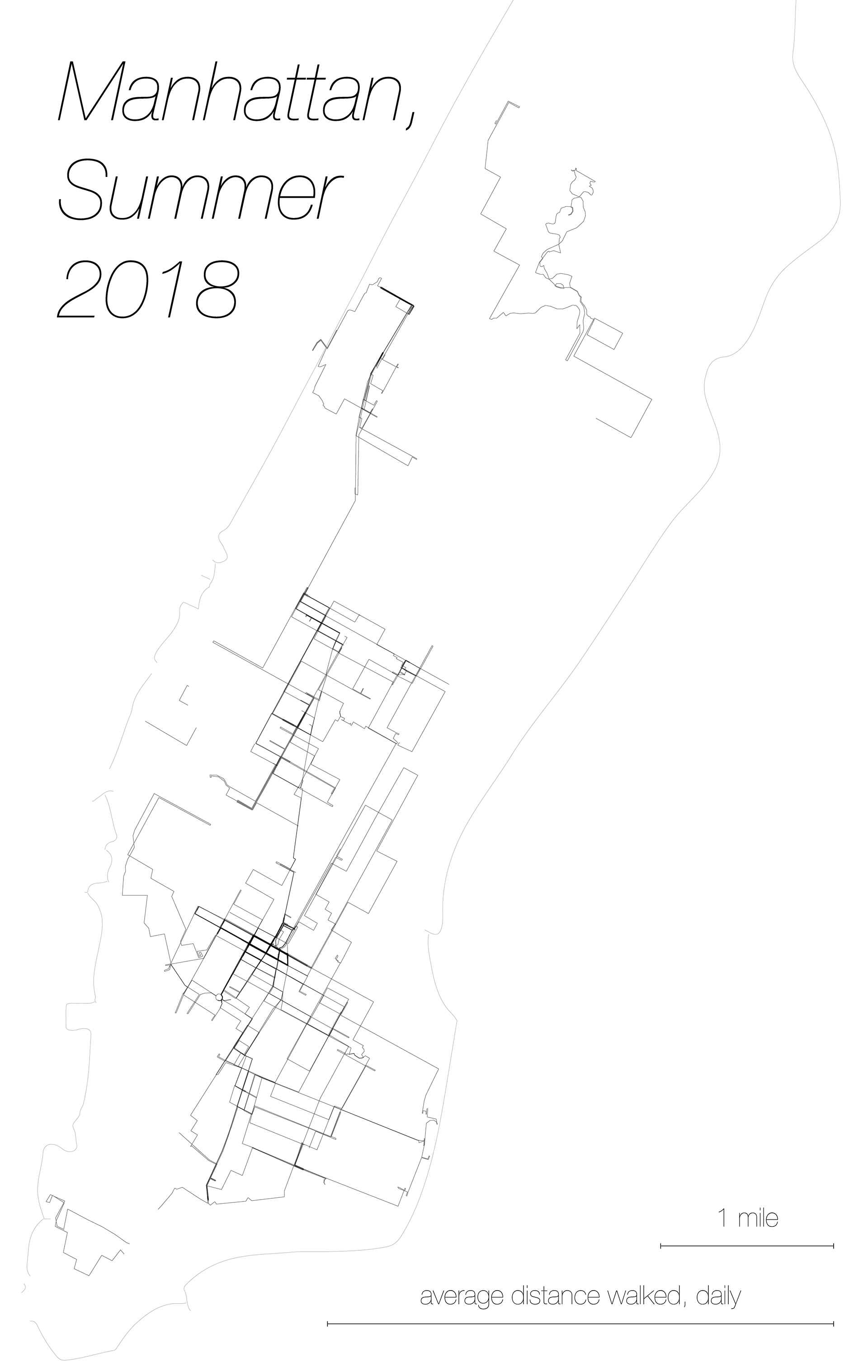
This project was inspired by an idea from one of my design classes, which was to explore the scale of the world we live in. A classmate wanted to log and visualize his commute every day, and compare his travel distance with length scales of the city he lived in and his home. I liked the idea of that comparison and threw in my own visualization at the bottom of the map as a sort of legend. I walked several widths of manhattan every day, on average. The last bit which I didn't have the energy to finish (and think would ruin the simplicity of the map) was to compare this with my average commuting distance to get from Brooklyn to Manhattan, which was several times my average walking distance once I was in the city!